
Quick report
Cleared the Brooks interval board, last cleared on 12/23. On the board: 12 inches of snow, 2.5 inches SWE. HS at Brooks weather station 36 inches (3" less than measured on 12/22).
Dug at 9400 feet, NE aspect:
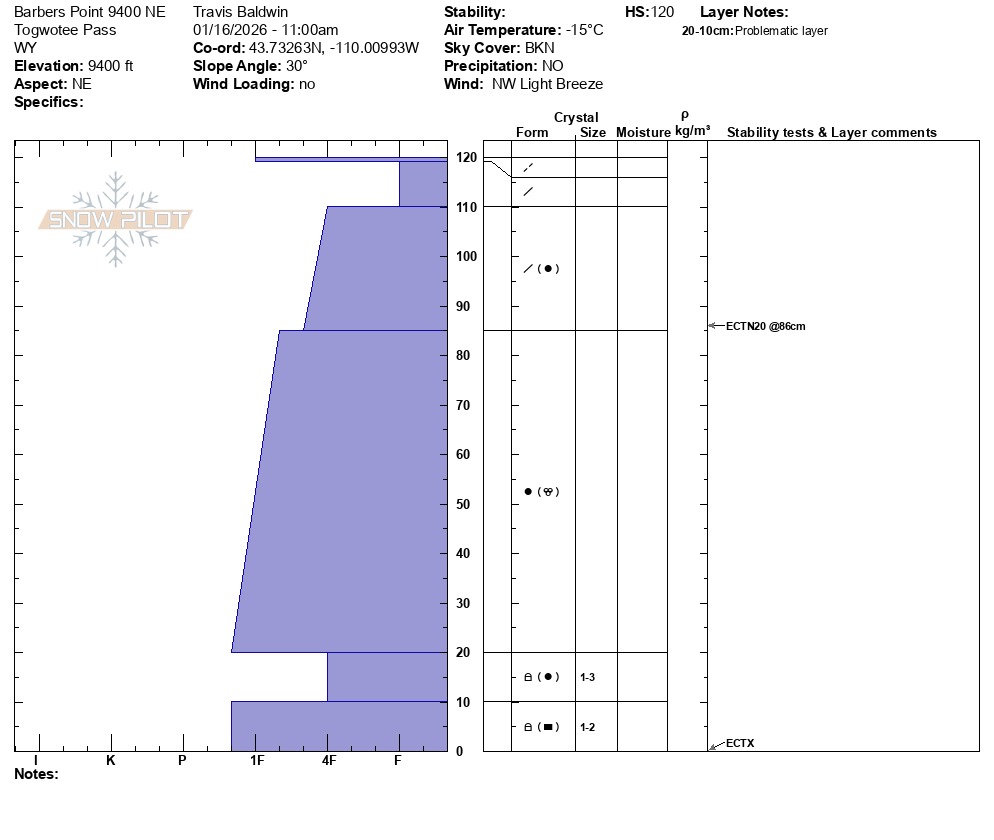
HS 47 inches (120 cm) ECTN20 down 14 inches with no discernible interface. ECTX with the column isolated to the ground.
While a recent lack of loading and generally warmer temps (with the exception of today, we have had 5 days of temps climbing to above freezing at the Brooks station -9340'), the snowpack has had time to adjust and gain strength. The likelihood of triggering an avalanche slowly decreases, but weaker snow still exists at the base of the snowpack. Continue to look for thin spots in the snowpack where your sled could impact and collapse these basal weak layers. Terrain traps below very steep slopes should still be avoided.
No signs of instability.Weather
- Air Temp
- 5
- Cloud Cover
- broken
- Wind Loading
- none
- Snow Avail For Transport
- small smounts
5-10 degrees and a light NW wind with moderate gusting on ridgetops.
Snowpack
Recent wind, sun and warm temps have done a number on surface conditions at Togwotee. There is a mix of sun crusts (some supportable some unsupportable) on sunny slopes, wind sculpted surfaces with hard and soft sastrugi, supportable windboard and soft snow/near surface facets in sheltered areas and north facing slopes. Windward, exposed slopes and those exposed to the sun are thin in many locations with bare ground showing in places.