
Quick report
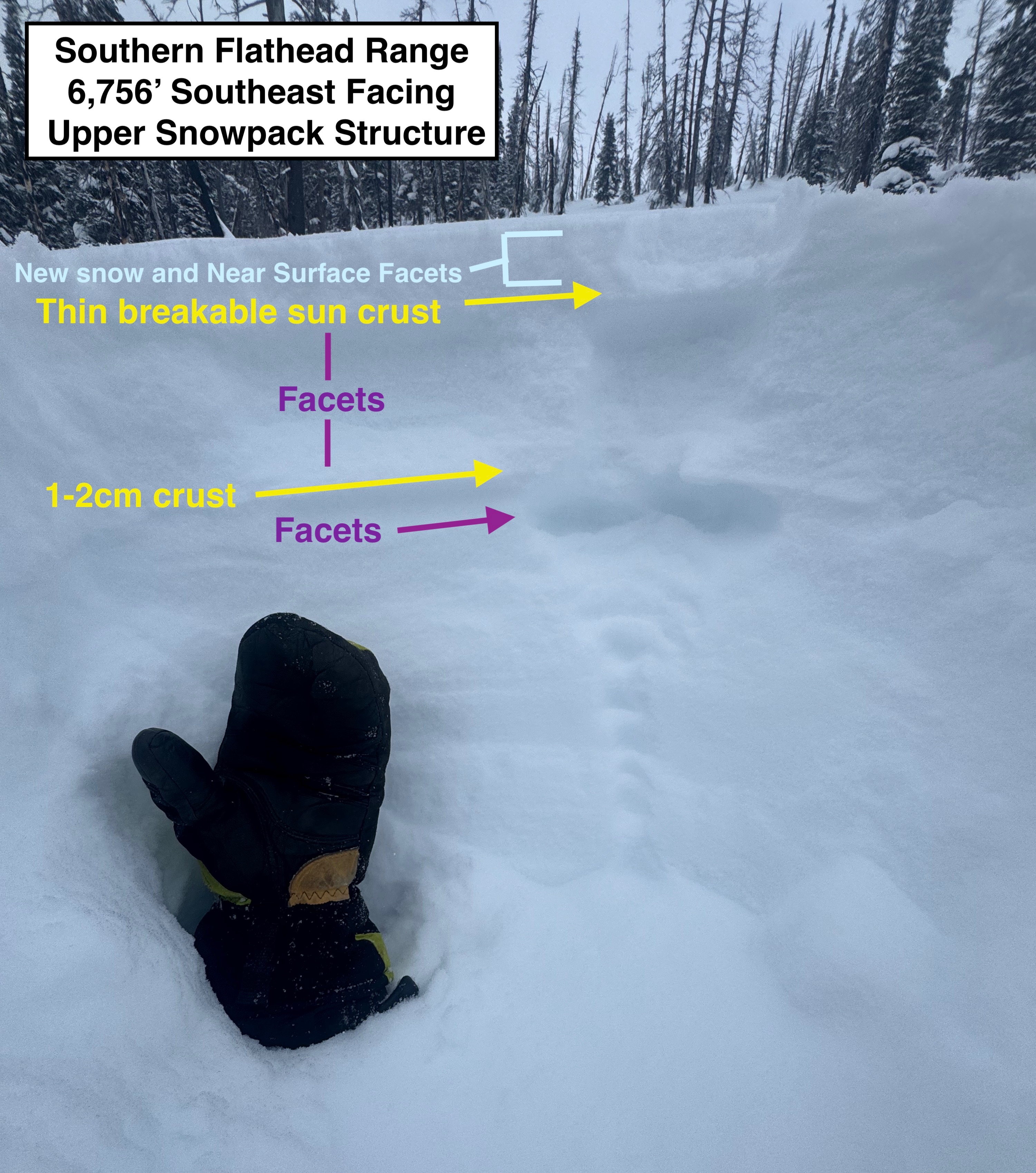
Went out to enjoy another day off in the Middle Fork. Objective was to hunt down some soft snow to ski and continue documenting recent changes in the upper snowpack structure. • 1 inch or less of recent snow at lower- middle elevations, and 3-4" in shelter upper elevation terrain. Very light snowfall accumulations throughout most of our tour, but this new snow amounted to less than half an inch. •We ascended through east facing and south facing terrain from the canyon floor to our ridgeline. South facing slopes do not harbor desirable riding conditions at this time with a combination of old wind slabs and breakable sun crust covered by a thin layer of soft snow. •Dug a quick hand pit at ~6800' on a south facing slope to take a closer look at the upper snowpack structure. There are two distinct crust within the top 10 inches of our snowpack. The upper crust here was a thin breakable sun crust capped by 1-2 inches of recent PP and near surface facets. The next crust was about 8 inches deep, slightly thicker, and more robust. The snow between the two crust is weak and faceted, and the underside of this second crust also felt a bit faceted, but more subtle. This weak structure will be something to keep an eye on when we get our next round of precip later this week. • Winds were very calm until we ascended into upper elevations. Above 6,500' winds were steady but light out of the W-NW. We estimate that they were 5-10mph. We did not observe any active wind loading or drifting snow with these light winds. •Due to the lack of recent wind slab development the last two days, we felt comfortable stepping out into a steep east/northeast facing bowl. Riding conditions were mostly good, but there was a little bit of wind board under the recent snow to keep us on our toes. We didn't encounter this during our tour yesterday in a relatively nearby location. We attribute this to some of the erratic and variable wind effect that is common during arctic intrusions. No signs of instability observed.
Weather
- Cloud Cover
- overcast
- Wind Loading
- previous
- Recent Snowfall
- 1
- Snow Avail For Transport
- small smounts
Cold (single digits), Cloudy, and very light snowfall throughout the day. Winds were calm at lower and middle elevations. And blowing lightly out of the West/Northwest above ~6,500'.