
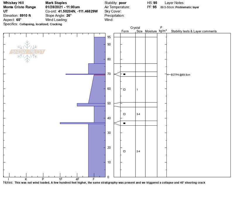
Quick report
- Aspect
- East
- Red Flags
- Wind Loading
- Elevation
- 2713 m
- Slope Angle
- 26°
Lots of wind loading today and there has been plenty of new snow for south winds to transport. The weakest layer in the snowpack seemed to be a thin layer of near-surface facets just under a thin crust just under the new snow. Trent and I found the same layer above Bountiful. You can see this layer just under the new snow in the photo below. You can see it propagate a crack in an extended column test after 4 light taps (ECTP4) in the video below. Also, the upper 4-6 inches of snow would consistently break but this is likely a very short lived weakness. The entire bottom half of the snowpack (at least) is weak, faceted snow that will be a problem for a long time.
We did trigger some collapses and shooting cracks. A photo below shows a short one. One of the longest in a wind loaded area was about 40 feet long.
Photo below showing how the upper 4-6 inches of new snow would crack but this is a short lived weakness.
Snowpack
Creamy dense powder. About 10" of settled new snow since last weekend. About 2-4 inches of new snow since last night.