
Highway 93 corridor
Weather
- Air Temp
- 30
- Cloud Cover
- few
- Wind Loading
- none
- Rain Elevation
- n/app
- Recent Snowfall
- 1-2 inches at 5500'
- Snow Avail For Transport
- small smounts
Light snow to start the day, warm cloud below 5000' but no rain observed. Skies cleared by mid morning. Little to no wind.
Snowpack
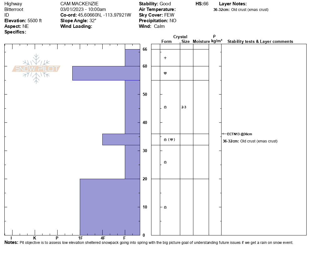
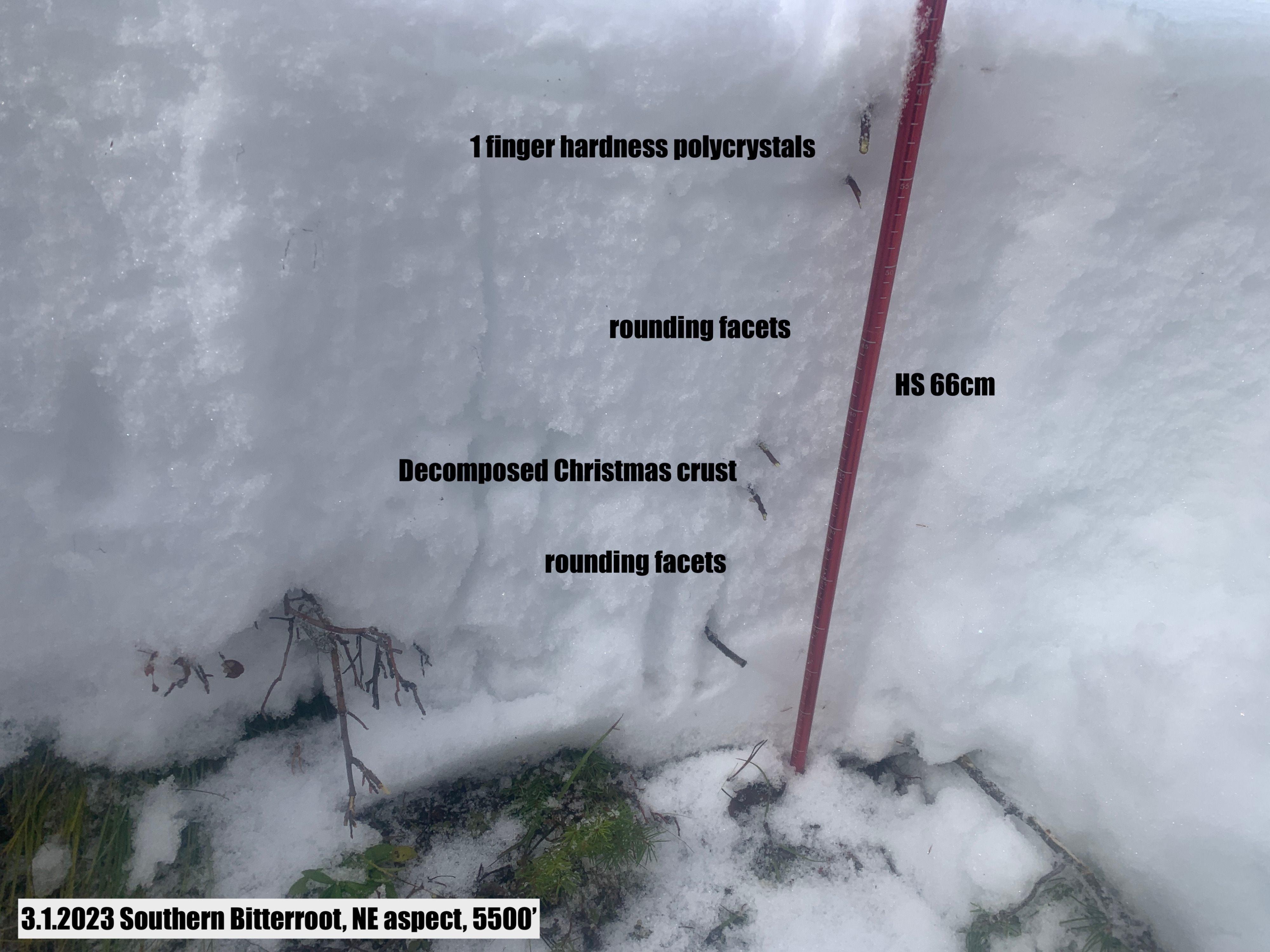
March 1st, spring is here it definitely feels like it at low elevation. Todays goal was to look at the snowpack structure in sheltered terrain at low levation. North and east aspects are holding between 50 to 75 cm of snow between 5000' and 6000'. Overall the snowpack is composed of non cohesive rounding facets. The christmas rain crust has mostly faceted out and is no longer a factor. The rain event late January has created a layer of rounded polycrystals with percolation columns vertically through the snow below but not a continous rain crust.
Overall, if we get a rain on snow event at low elevation in the next few weeks, I anticipate widespread wet loose avalanches at low elevation in north facing terrain but no wet slab cycle.
Last week, wet loose avalanches along highway 93 in west facing terrain ran through dirt at low elevation all the way to the highway. Looking at the amount of snow availble in start zones, this trend will likely continue.