
Quick report
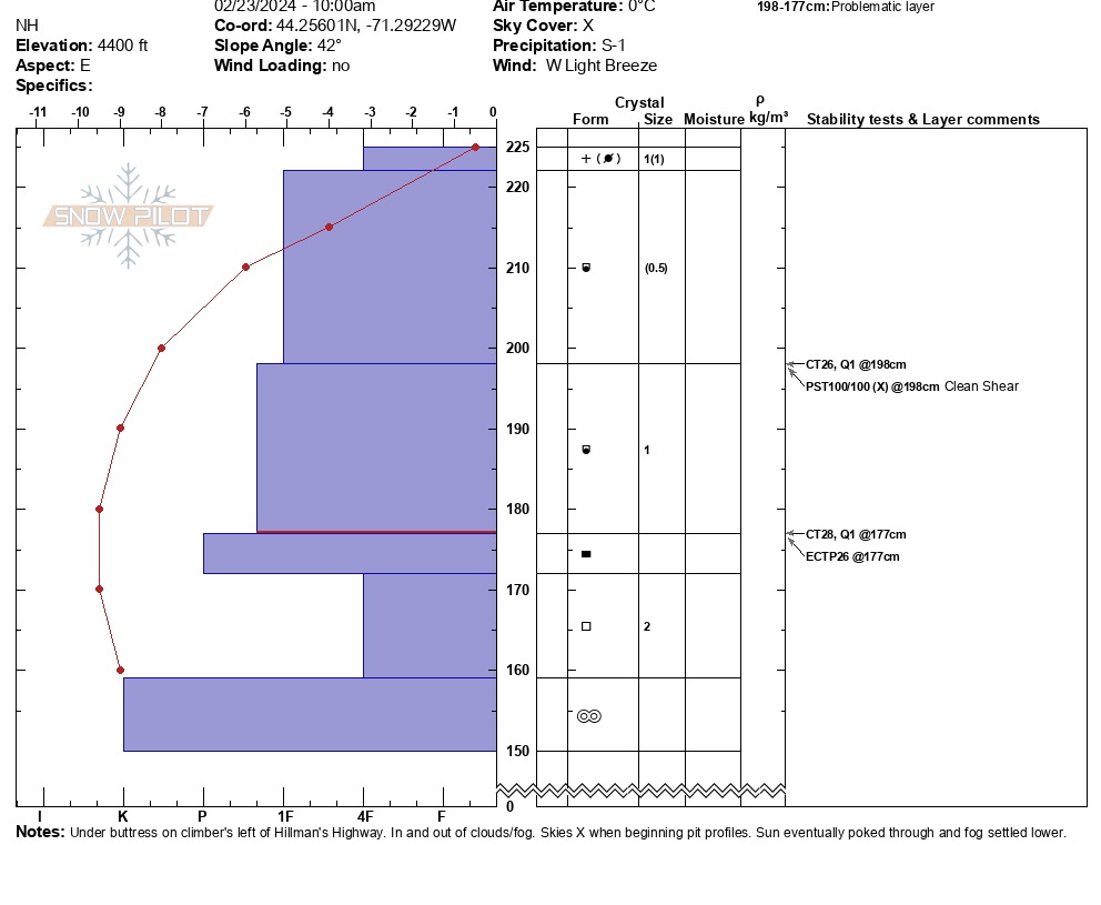
Overall, we observed slabs that were stubborn, but also had propagation potential in multiple layers. This seemed in line with the forecast over recent days, including the mention of possibility for step down avalanche problems. The observed early faceting within the newish snow was something to note with colder weather coming in. The overall temperature profile (see snowpilot) is conducive to this trend. We conducted a series of stability tests with the following results: - CTH Q1 down 27cm on the weak interface - CTH Q1 down 48cm on the faceting rounds/ice crust - ECTP26 Q1 down 48cm on the same layer above - PSTX with a clean shear after running the saw all the way through We also conducted multiple hand shears with mixed sensitivity and observed a few rounds of roller balls between 1030 and 1100.
Weather
- Air Temp
- 33
- Cloud Cover
- obscured
- Wind Loading
- none
- Recent Snowfall
- 2
- Snow Avail For Transport
- none
In and out of the clouds, with a fog eventually settling just below Hermit Lake. Light west winds.
Snowpack
Total snow depth observed was 225cm. We found 3cm of new snow on top of the large, preexisting wind slap. The wind slab was broken up into two layers (24cm of 1F hardness over 21cm of 1F+), which sat on a crust layer. Under a lens, we observed some early signs of angulation in the rounded particles that made up the two layers of the slab. This, coupled with our temperature profile, led us to conclude that these grains are beginning to facet. The slab sat on a hard ice crust over a 13cm layer of 2mm facets and another, thicker, harder melt freeze crust.