
Quick report
- Aspect
- West
- Red Flags
- Poor Snowpack Structure
- Elevation
- 2926 m
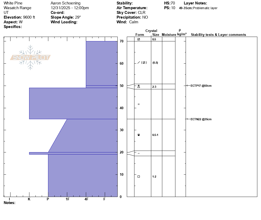
Traveled from the White Pine trailhead into the upper part of the drainage. Coverage below 9000' is poor and travel conditions along the summer road on the east side of the drainage are detoriating. There are multiple patches of exposed rock and dirt combined with several downed trees across the road. Soft snow could still be found on many lower angle sheltered slopes. Anything with a south tilt, even lower angle slopes, has taken heat from the sun over the last couple days with has developed a crust. HS 30-90cm. Clear skies and calm winds throughout the day. Felt more like April than December.
Photo 1 shows weakening surface snow, with SH developing in sheltered areas.
Photo 2 shows the surface crust forming on solars.
Snowpack
- Instability Comment
- <p>Poor structure still exists in the snowpack. Did not get any notable results ECT results on the basal facets (isolated below the rain crust). Found developing facets underneath the Christmas rain crust. The surface snow in many locations is weakening, something to keep an eye on with incoming precip later in the week.</p>