
Quick report
Conditions were stable today in the area I traveled. As the storm continues and the amount of new snow increases, I would expect the stability to decrease. The bond between the new and old snow is my primary concern. If enough new snow accumulates and a slab builds an avalanche could step down to one of the crust/weak snow layers in the upper snowpack.
Weather
- Air Temp
- 27
- Cloud Cover
- overcast
- Wind Loading
- none
- Rain Elevation
- N/A
- Recent Snowfall
- 20
- Snow Avail For Transport
- moderate amounts
Light to Moderate snow. The winds were calm for most of the day. There were some gusts in the moderate range in the afternoon from the SW.
Snowpack
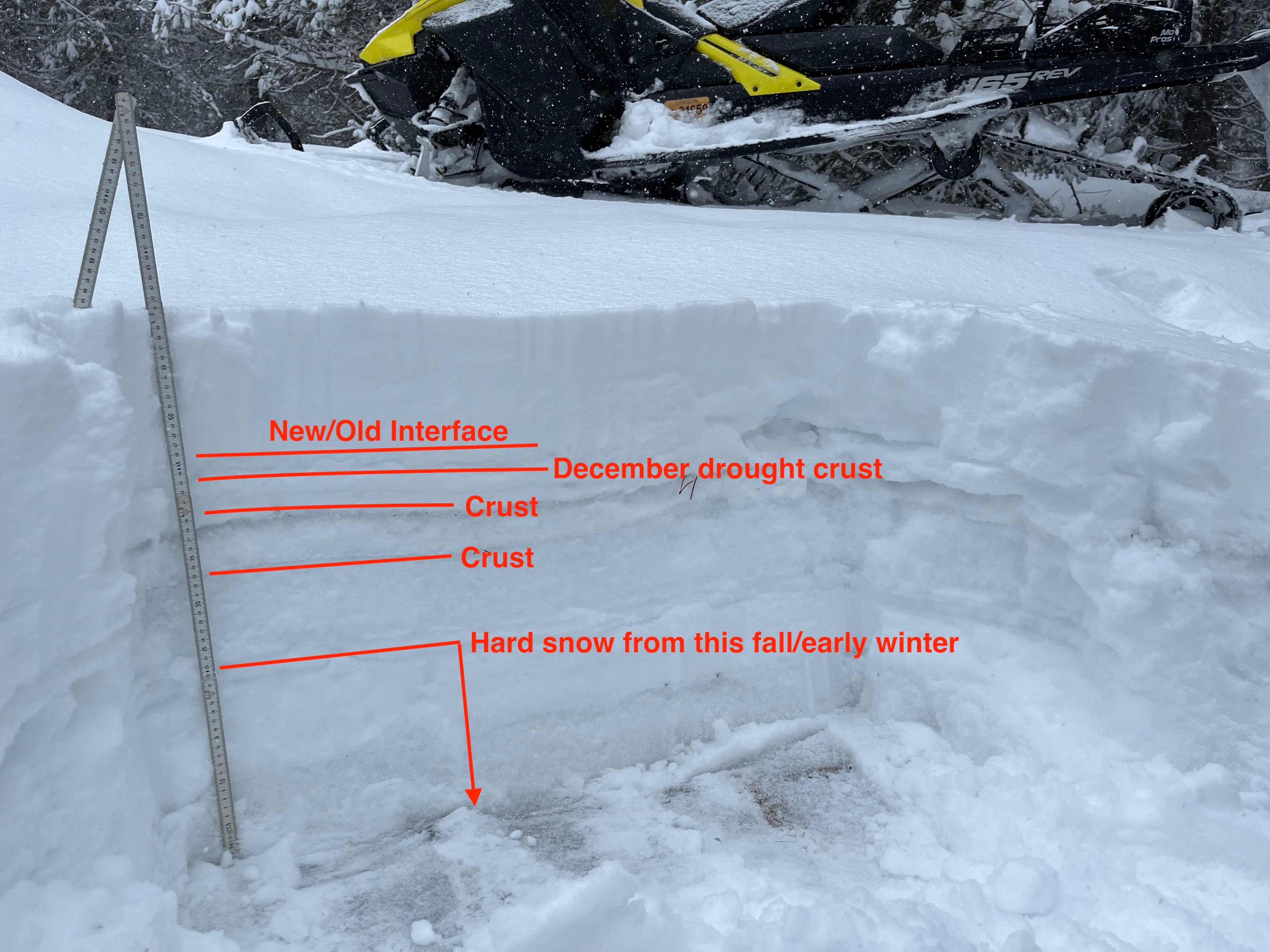
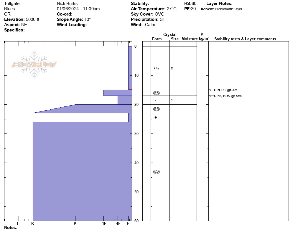
I found 60cm/2ft of snow at 5000'. I observed a stable snowpack in the locations I dug today. In informal snowpack tests, I observed the bond between the new and old snow to be weak. Hand shear and shovel tilt tests produced easy shears at the new old interface. I observed near-surface facets and preserved precipitation particles at that interface. There are two crust/weak snow sandwiches in the top 30cm/1ft of the snowpack. Neither of them was reactive in snowpack tests. The bottom 30cm/1ft is very strong melt-freeze snow.