
Quick report
- Aspect
- North
- Red Flags
- Rapid Warming
- Elevation
- 3109 m
- Red Flags Comment
- <p>By early afternoon, the warmth and greenhousing took its toll on the snow and you could just almost get push-a-lanches to move down steep terrain; any aspect would do. </p>
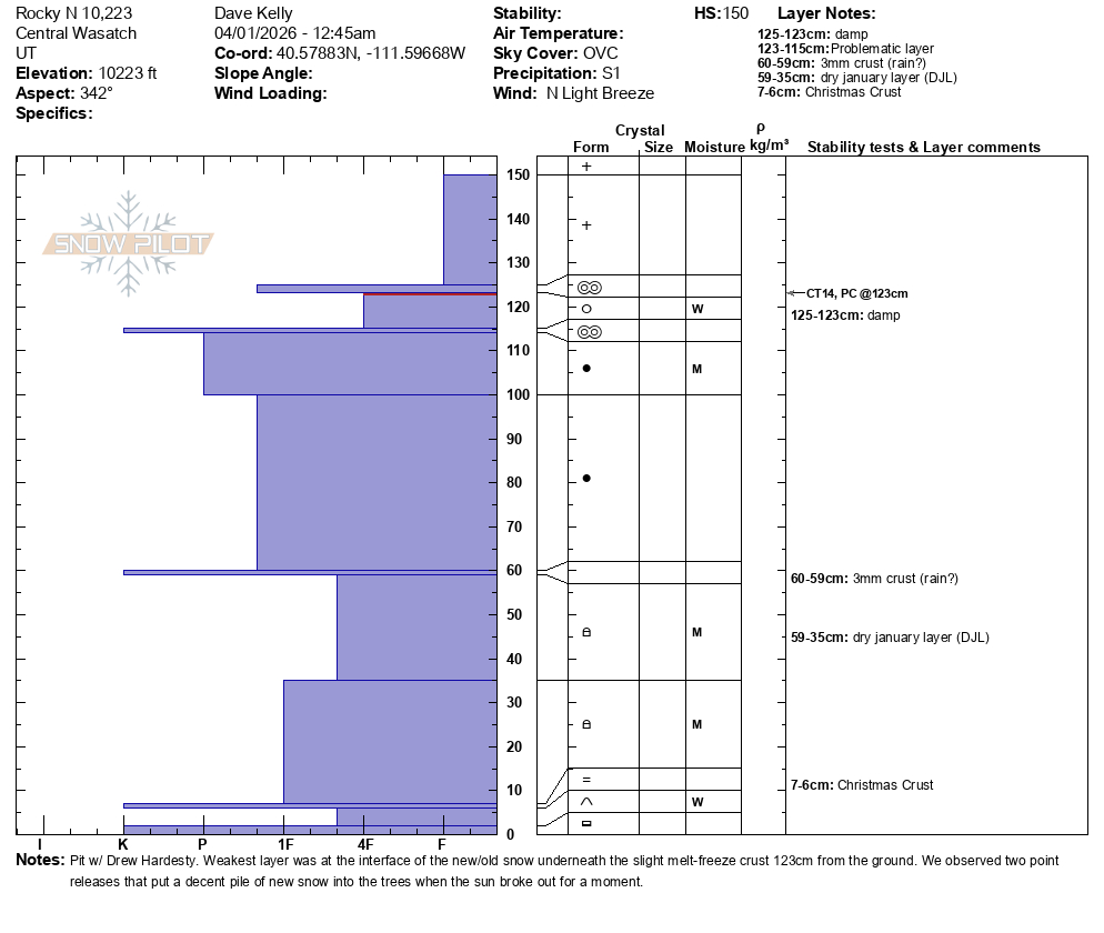
Layer of greatest concern was 4' (123cm) from the ground below a slight melt freeze crust under the newest snow. We were able to get results (CT14PC/Q2) at this layer. We were also able to tease out a fracture when we isolated a block (photo below).
Overall the old snow was still isothermal (same temperature) in places and on south-west facing slopes where there was more than just the new snow we were able to sink our ski poles basket side down to the ground in some locations.
Snowpack
- Instability Comment
- <p>First photo of a small wet loose sluff from the heating/greenhousing; second pic is that the refreeze is superficial (yet supportable) ~ 1-2cm but the warm new snow has insulated the isothermal snowpack and one can push a ski pole to the bottom of the snowpack. Last pic os of the 6-8" of new above wet grains (that may take awhile to 'lock-up', even with a strong cold front due Thursday.).</p> <p>At some point, I would expect to see longer running wet sluffs gouging into these unconsolidated layers, perhaps as soon as later Friday - or whenever the sun/heating reappears.</p>
Damp and sponge-y, but seemed to bond well to the 1cm thick superficial refreeze.
In some ways, it felt like November with many solar and off aspects fraught with obstacles, now thinly veiled by the new snow.