
Hum Saddle and 8,443’ North of Beaverdam
Quick report
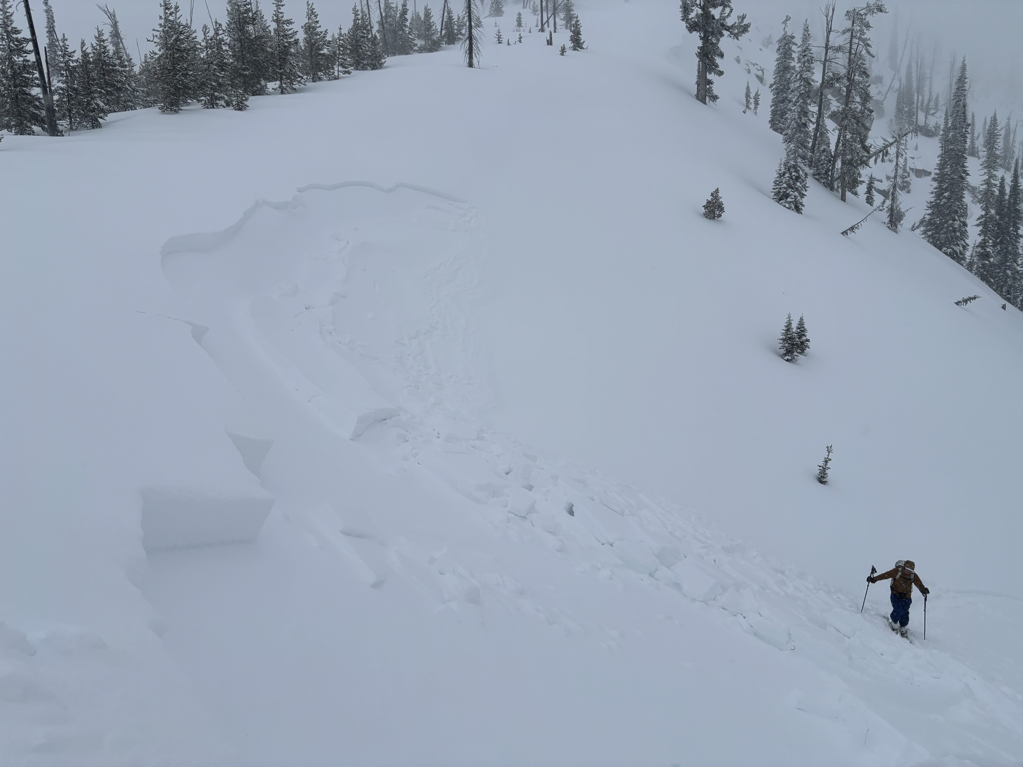
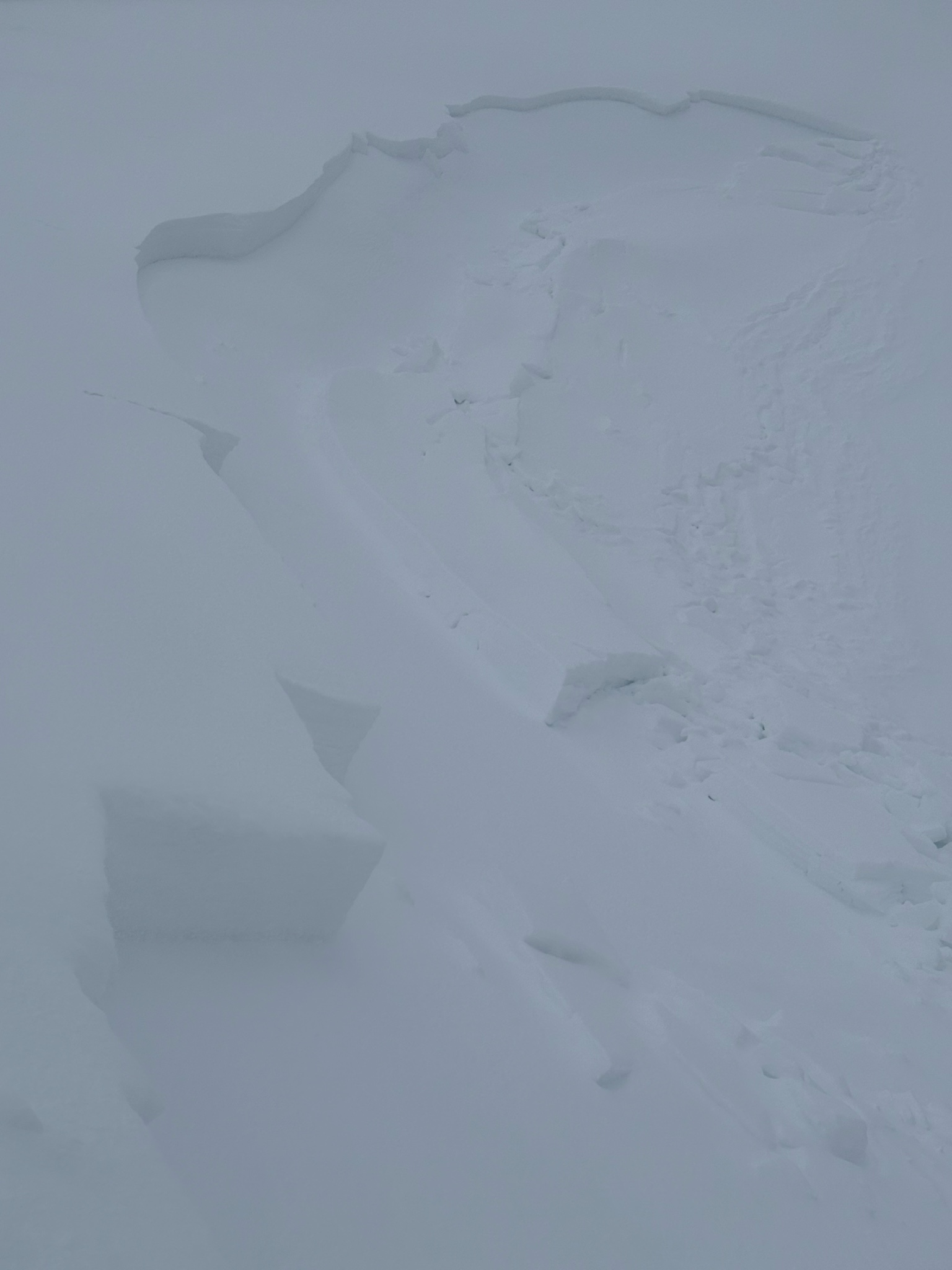
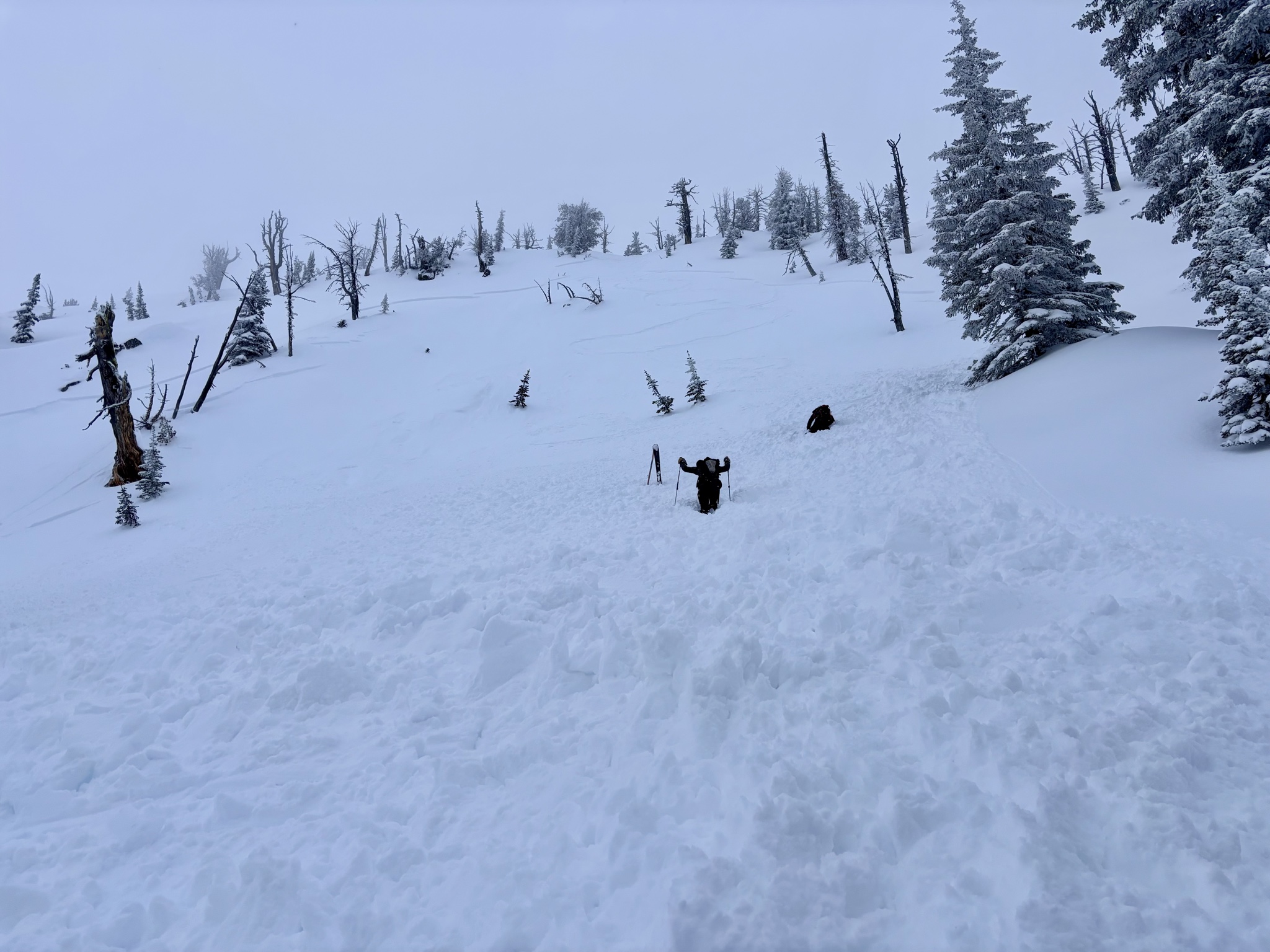
We snowmobiled out to the Duck Lake trailhead and toured on skis up to Hum Saddle. We found more new snow than anticipated (around 6 inches above 7,000’). Skiing one at a time, skier 1 dropped into the small, NE-facing catchers mitt feature towards Hum Lake and skied out to the left via low angle benchy treed terrain. Skier two dropped in to the right of skier one and on the first turn triggered a soft slab avalanche that ran about 30 feet to where the small terrain feature mellowed/benched out. The soft slab seemed to have failed on buried surface hoar and the crown ranged in depth up to 18 inches. The slab was approximately 30 feet wide, however, shooting cracks were observed both to the left and right of the avalanche. Skier 2 skied away from the slide uneventfully and followed skier 1 into the mellow, treed terrain. Skier 3 joined the other two skiers and at the bottom of the run, we reassessed our plan for the day. We opted to bail on our longer, more committing tour and decided it was a storm skiing day. We toured back up to the saddle to further investigate the avalanche via low angle terrain and skied back to the sleds. We did not observe any collapsing, cracking, or whumping while traveling. The group chose to head towards the basin to the northeast of Beaverdam to tour up to some short, treed runs and made the plan to avoid avalanche terrain based on the experience earlier in the day. We skied a short north-facing run back into the basin and toured up to another saddle on a SE aspect. From the 8,400’ high point, we skied a low angle NW run down into the Crestline, and toured back up to the 8,400’ high point to begin our exit. From the high point, we discussed skiing back down our skin track on the SE aspect from the saddle, or dropping in a bit higher up the ridge, which had a steeper entrance. After the full day of covering ground on skis on a variety of aspects, around 10 miles and 6,500’ of climbing, we had gained some confidence that a cohesive slab was not prevalent in terrain on this aspect. We chose to ski into the line from the steeper entrance and chose a spot that avoided dropping in above terrain traps in the benchy terrain. Skier 1 skied two turns and triggered a shallow avalanche on the rollover that failed beneath the new snow around 6 inches down. The avalanche propagated to both sides and skier 1 was knocked off his feet while attempting to ski out of the slide towards the lower angle safe spot that was identified prior to dropping in. Skier 1 lost both skis and tumbled for 20 feet but was not buried. The avalanche ran approximately 400 feet. Skiers 2 and 3 skied down on the bed surface to help locate missing skis. After failing to find both skis, skis were adjusted and two of the skiers skied out on 1 ski. Fortunately we were on our exit and were able to ski/glide all the way out via low angle terrain that followed our skin track.
Avalanche
- Size
- D1.5
- Type
- SS
- Count
- 2
- Aspect
- E
- Trigger
- AS
- Elevation
- 8300 ft
See field notes