
Quick report
The snowpack as a whole continues to get deeper, and lower snowpack layers are not showings signs of weakening. This area, like many other places in our forecast zones, received rain last Friday and Saturday morning forming another rain crust across all aspects. We found evidence of the last rain event above 7,000 feet. Abundant lower-density snow on the surface will easily be transported onto leeward slopes if winds increase significantly over the next few days.
Weather
- Cloud Cover
- obscured
- Wind Loading
- moderate
- Recent Snowfall
- 40cm since Saturday
- Snow Avail For Transport
- moderate amounts
Mix of overcast and broken skies to start. Then the fog and clouds settled in along with light snowfall. Moderate winds at upper elevations and along ridgetops.
Snowpack
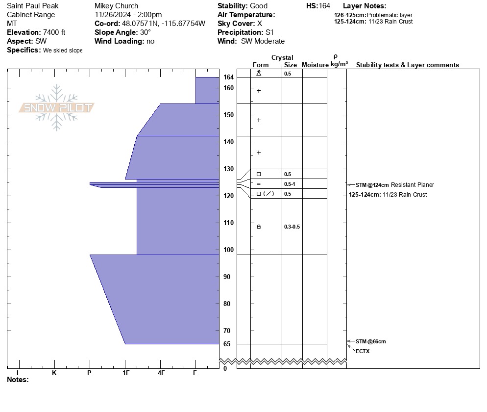
Around 40cm of new snow has piled up on top of the 11/23-24 rain crust since Saturday. At mid elevations the crust is thicker and more supportive. Around 6,800 feet give or take, the crust is thinner and weaker. Digging on a southwest-facing slope, we found the crust to be about 1cm thick with facets forming both above and below. Although Extended Column Tests did not produce propagating results, the potential to trigger a slide likely increases on slopes where the overlaying slab is thicker and stiffer - such as the lee side of terrain features that face north through east to southeast. Additionally, cross-loaded slopes and areas below ridgelines should be approached with caution and an exit strategy. The weather over the coming week will heavily influence whether this layer turns problematic. Mild temperatures and additional snowfall will likely slow down the faceting process, but cold and dry conditions could promote further weakening of these still shallowly buried facets around the crust.