
Quick report
We enjoyed deep snowmobiling in the recent storm snow despite the frigid temperatures. Recent wind drifting from the extreme winds earlier this week was evident, with some exposed southern slopes scoured to the ground and deep drifts in the adjacent gullies. Lower elevations now have plenty of snow for riding, but we still found a few hidden obstacles. Above 6000ft, coverage was much better. We didn't see any obvious signs of instability, but we avoided avalanche terrain and stayed in locations sheltered from the wind.
Weather
- Air Temp
- -12 C
- Cloud Cover
- overcast
- Wind Loading
- previous
- Recent Snowfall
- 50-70cm of recent storm snow
- Snow Avail For Transport
- large amounts
Extremely cold! The bitter temperatures and lack of sun took careful management to prevent cold injuries while riding. Thankfully, winds were light and variable. It began snowing lightly around 3 pm, picking up to S1 by 4 pm.
Snowpack
Observations were limited because we needed to keep active to stay warm due to the extremely cold temperatures.
The snow height at 4900ft was about 80cm, with a thin melt-freeze crust down 70cm. So, nearly the entire snowpack at these elevations accumulated this week.
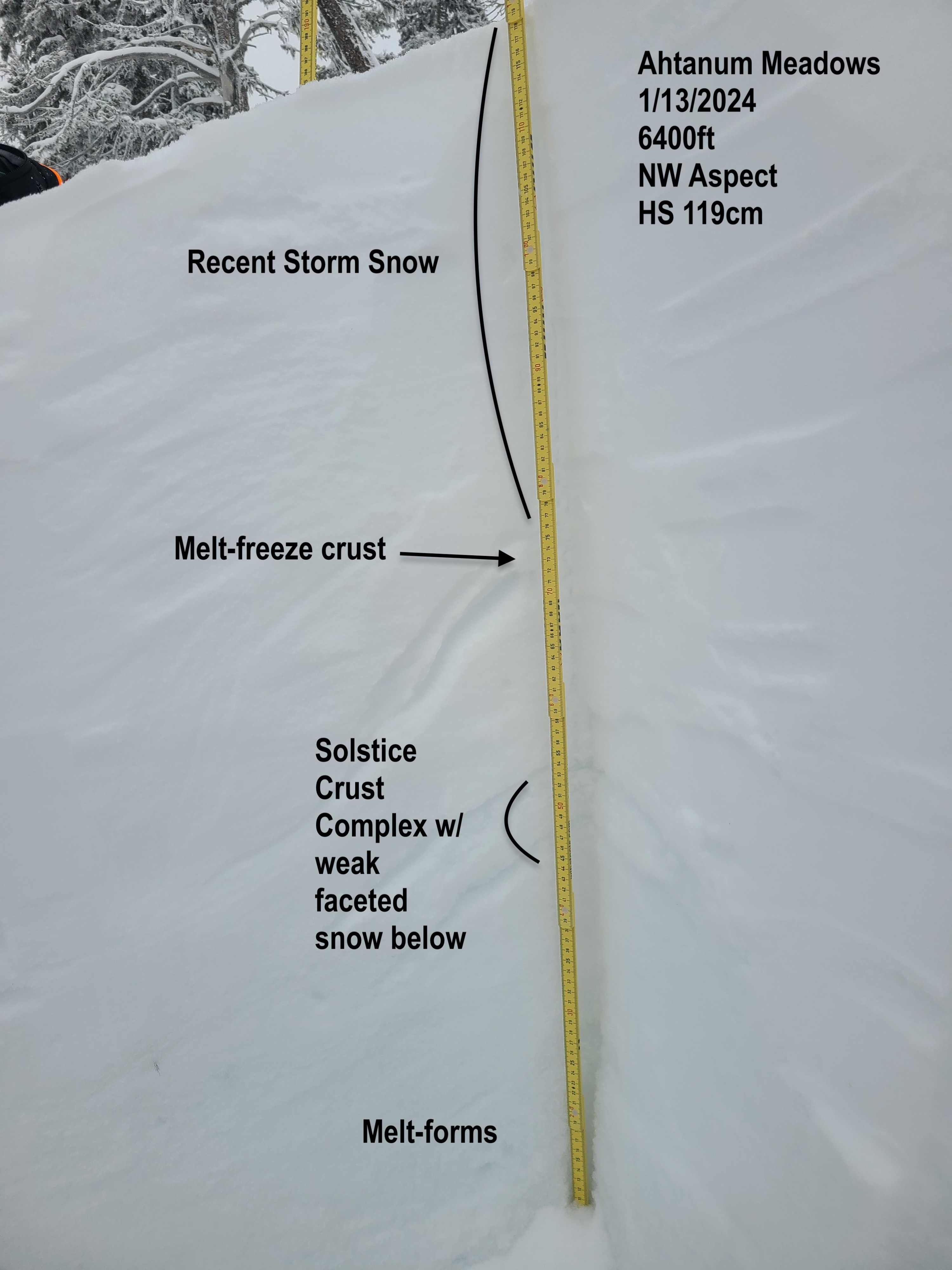
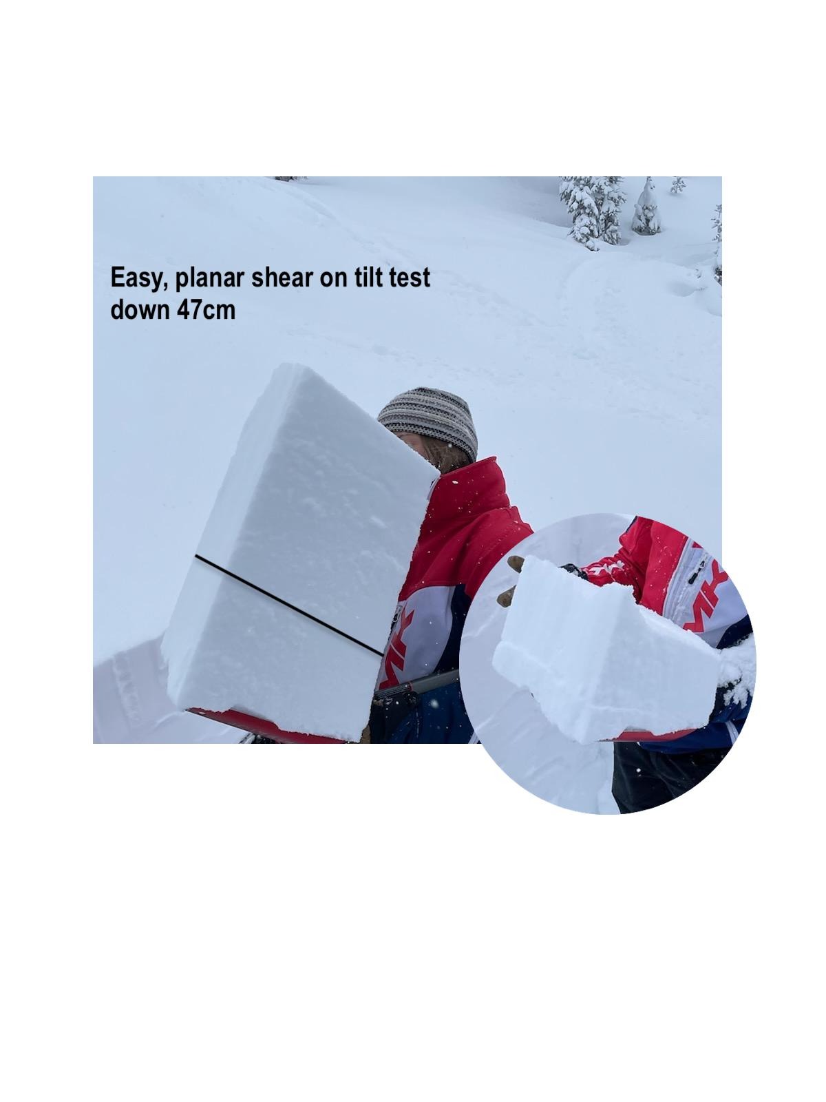
At 6400ft on a NW aspect, we found 119cm of snow. The upper snowpack is right-side-up storm snow from Fist to Fist + hardness. There are some recent interfaces in the storm snow that produced clean shears in shovel tilt tests and compression tests. Below the storm snow is a thin melt-freeze crust. Below this crust are rounding grains to the Solstice Crust complex. There is weak, faceted snow above and below the Solstice crust, but snowpack test results in this location were unremarkable. The lower snowpack is melt-forms and rounding faceted grains.