
Quick report
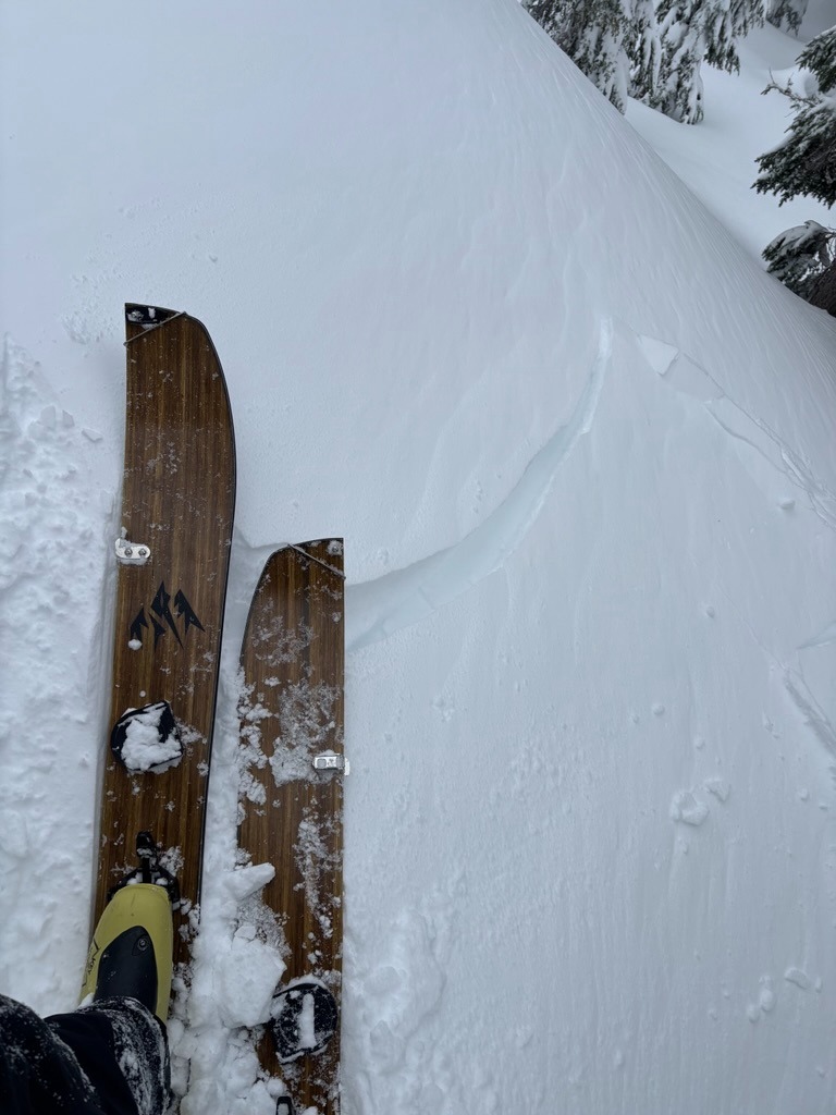
- Cracking
- specific
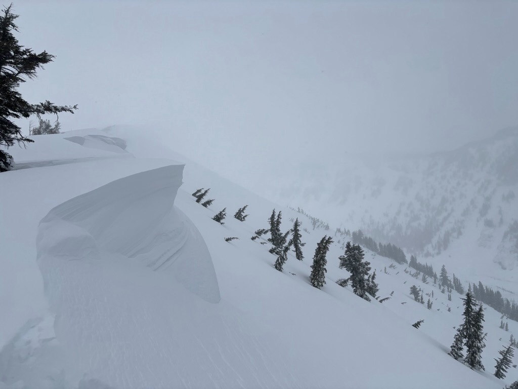
The new 8-12 inches of new snow felt nice, but weak snow around the January drought layer (JDL) kept us traveling conservatively, especially as we crested into the wind zone above 5800 ft. The new snow bonded differently from slope to slope, but seemed most concerning on more shaded aspects.
Instability was confined to wind-loaded features in this area.Weather
- Air Temp
- Upper teens
- Cloud Cover
- overcast
- Wind Loading
- moderate
- Recent Snowfall
- 25-30 cm
- Snow Avail For Transport
- moderate amounts
Snowpack
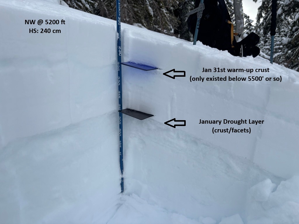
New snow is finally stacking up over our January Drought Layer (JDL). We poked around on several different aspects/elevations to track the change in sensitivity over the terrain.
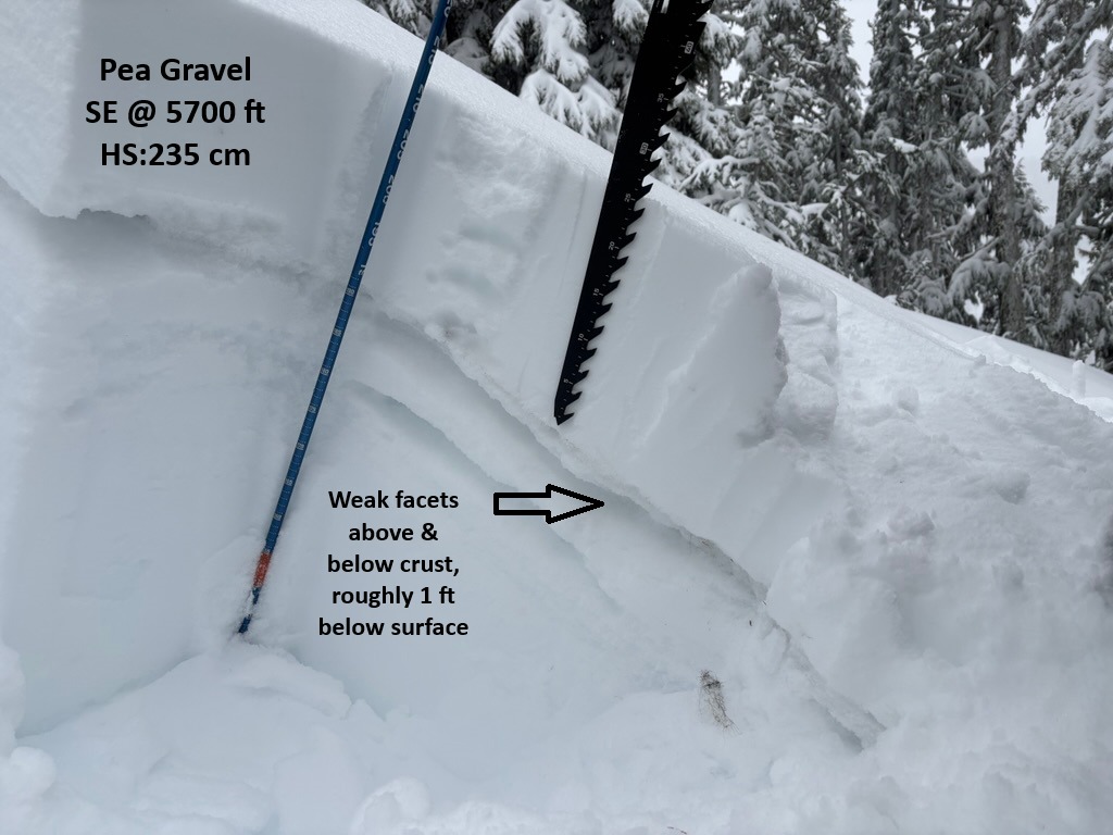
Below 5500 ft, there isn't really enough to be much of an issue outside of wind loaded features. However, as we climbed above this the new snow started stacking up and ranged from 8-12 inches. In these locations, we started finding more noticeable signs of instability in wind-loaded and some non-windloaded terrain.
Test profiles above 5500 ft on both west and east aspects revealed weak snow around the JDL crust roughly 1 ft below the surface. However, on the W aspects we found this crust to be thicker and more supportable. E aspects held a fragile, weak crust that harbored a thicker layer of facets between the crust sandwich in the upper 'pack. This layer showed the ability to propagate with PST's ( PST 40/100 end x2) and produced SC results with CT's on low scores.