Lawinenlagebericht

Northwest Mountains

Crested Butte Avalanche Center
Auf der Karte ansehen

Lawinengefahr

Thu
Hochgebirge
3 · Erheblich
Waldgrenze
3 · Erheblich
Unterhalb
2 · Mässig
Veraltet — dieser Lagebericht ist 3 years ago abgelaufen. Du siehst vergangene Verhältnisse, nicht den aktuellen Bericht.

Kernpunkte

The warming snow surface could cause natural wet loose activity and/or make slabs in the upper snowpack more reactive, like yesterday afternoon's large natural persistent slab on Schuylkill Ridge.   Several wind slabs up to 2 feet thick were triggered by riders at higher elevations yesterday; this threat also continues.  The snowpack remains challenging.  The safest riding is on slopes less than 35 degrees protected from the sun and wind-loading.   

Lawinenprobleme

  • Persistent Slabs

    • Hochgebirge
    • Waldgrenze
    • Unterhalb der Waldgrenze
    Wahrscheinlichkeit
    Possible
    Größe
    2–3

    Last week's storm formed slabs up to several feet thick over faceted weak layers.  Remote triggers and natural avalanches failing on these persistent weak layers have been gradually diminishing since widespread activity peaked last Wednesday.  The greatest number of avalanches have occurred on easterly-facing slopes where faceted crusts exist. Similar structures are also found on westerly-facing slopes. On northerly-facing slopes, these slabs formed over a layer of near-surface facets which should be bonding better now.  Slabs are larger at higher elevations due to previous wind transport.  In a few cases, avalanches have stepped down into older weak layers much deeper in the snowpack, causing destructive avalanches.  

    Early warning signs for this avalanche problem are rare and feedback is infrequent. You can reduce your chance of triggering this avalanche problem by avoiding recently wind-loaded terrain, unusually shallow terrain, or slopes where the snow surface is getting hot and sticky.  Safer riding is on wind-protected, sun-protected slope angles less than 35 degrees, without steeper slopes above. 

    This large persistent slab ran naturally on the afternoon of 3/28 on Schuylkill Ridge.

  • Wind Slabs

    • Hochgebirge
    • Waldgrenze
    • Unterhalb der Waldgrenze
    Wahrscheinlichkeit
    Possible
    Größe
    1–2

    Winds have shifted from the northwest on Monday to the southwest today, forming drifts at higher elevations.   Yesterday, we spotted over a dozen recent natural wind slabs and our forecast team intentionally triggered a couple of similar wind slabs up to 2 feet thick.   A triggered avalanche in recently drifted terrain could step down and trigger a much thicker and wider persistent slab.   You can identify the problem by looking or feeling for thick lenses of drifted snow below ridges and in gullies. You can avoid the problem by traveling where the snow is protected or eroded by winds. 

    This 2-foot thick wind slab was remotely triggered near Hunter Hill on 3/28.  

  • Loose Wet

    • Hochgebirge
    • Waldgrenze
    • Unterhalb der Waldgrenze
    Wahrscheinlichkeit
    Possible
    Größe
    1–1.5

    Strong solar radiation and warming temperatures will moisten the snow surface on steep, sunbaked slopes protected from the wind, and could cause natural wet loose activity.  Watch for rollerballs, pinwheels, or active sluffing to alert you to changing conditions as the day warms up.  Although most wet loose activity should be small, sluffs can pack enough punch to injure or bury you in a terrain trap. There is also concern for a natural wet loose avalanche to trigger a much larger persistent slab.  Consider your overhead hazards if wet loose avalanches start happening.  

    A small natural wet loose avalanche that ran off of Mt. Crested Butte yesterday afternoon (3/28). 

Avalanche Discussion

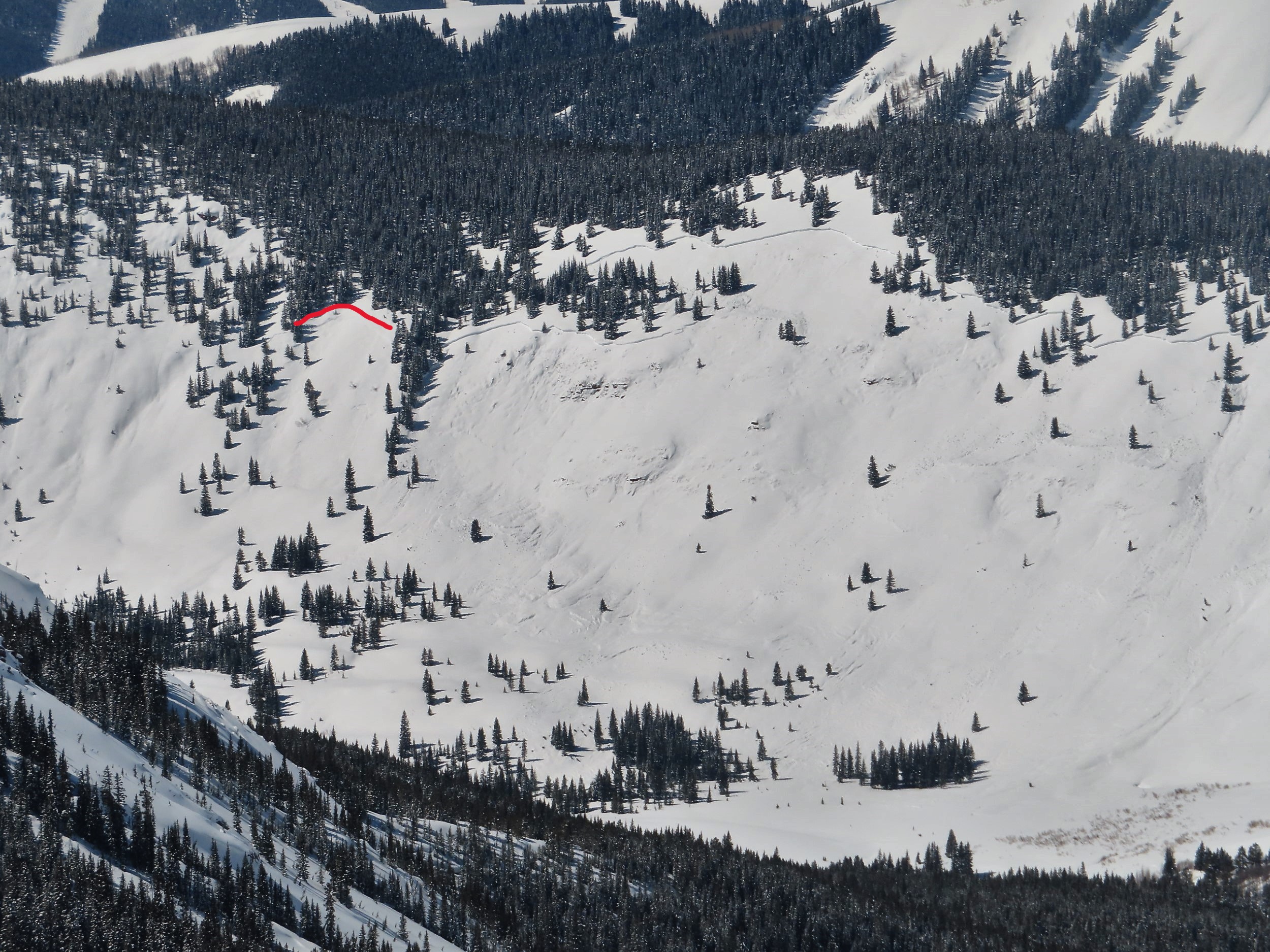
Yesterday, we observed the trifecta of persistent slabs, wind slabs, and wet loose avalanches.  More of the same is on tap for today.  A warming-related persistent slab ran yesterday afternoon on Schuylkill Ridge, and we spotted this fresh 2,300' wide crown on Teo Ridge that likely ran sometime in the past day or two.  The threat of natural or triggered avalanches like these remains a concern today with more significant warming expected, along with shifting/strengthening winds.  A much warmer start and higher temperatures expected today will be moderated a bit by stronger winds and the potential for more cloud cover.  If we get sustained sunshine, I expect we'll see an uptick in wet loose activity in wind-protected cirques and lower elevations on the southern half of the compass.  

Wind slabs from Monday's west-northwest wind event remained sensitive to triggers yesterday, particularly where the slabs formed over a sun crust that formed late last week.  Winds are now shifting back to the southwest and could form yet another generation of fresh slabs on more northerly aspects.  In windloaded terrain, persistent slabs are capable of producing very large avalanches, evidenced by several D3's in the past week.  Examples include this 2000' wide crown that ran over the weekend near Marble, this trio of very large avalanches triggered remotely in the Anthracites on Saturday, and this huge avalanche in Barcelona Bowl that ran during the big storm last Wednesday.  The most active aspects for avalanche activity this week have been on the eastern quadrant of the compass (NE to SE aspects). Concerning structures do exist on other aspects, so take the time to assess the snowpack wherever you are riding, or opt for simpler, less consequential terrain when in doubt. 

Abgedeckte Regionen