

Lawinenlagebericht

Northwest Mountains

Crested Butte Avalanche Center
Auf der Karte ansehen

Lawinengefahr

Sun
Hochgebirge
2 · Mässig
Waldgrenze
2 · Mässig
Unterhalb
1 · Gering
Veraltet — dieser Lagebericht ist 3 years ago abgelaufen. Du siehst vergangene Verhältnisse, nicht den aktuellen Bericht.

Kernpunkte

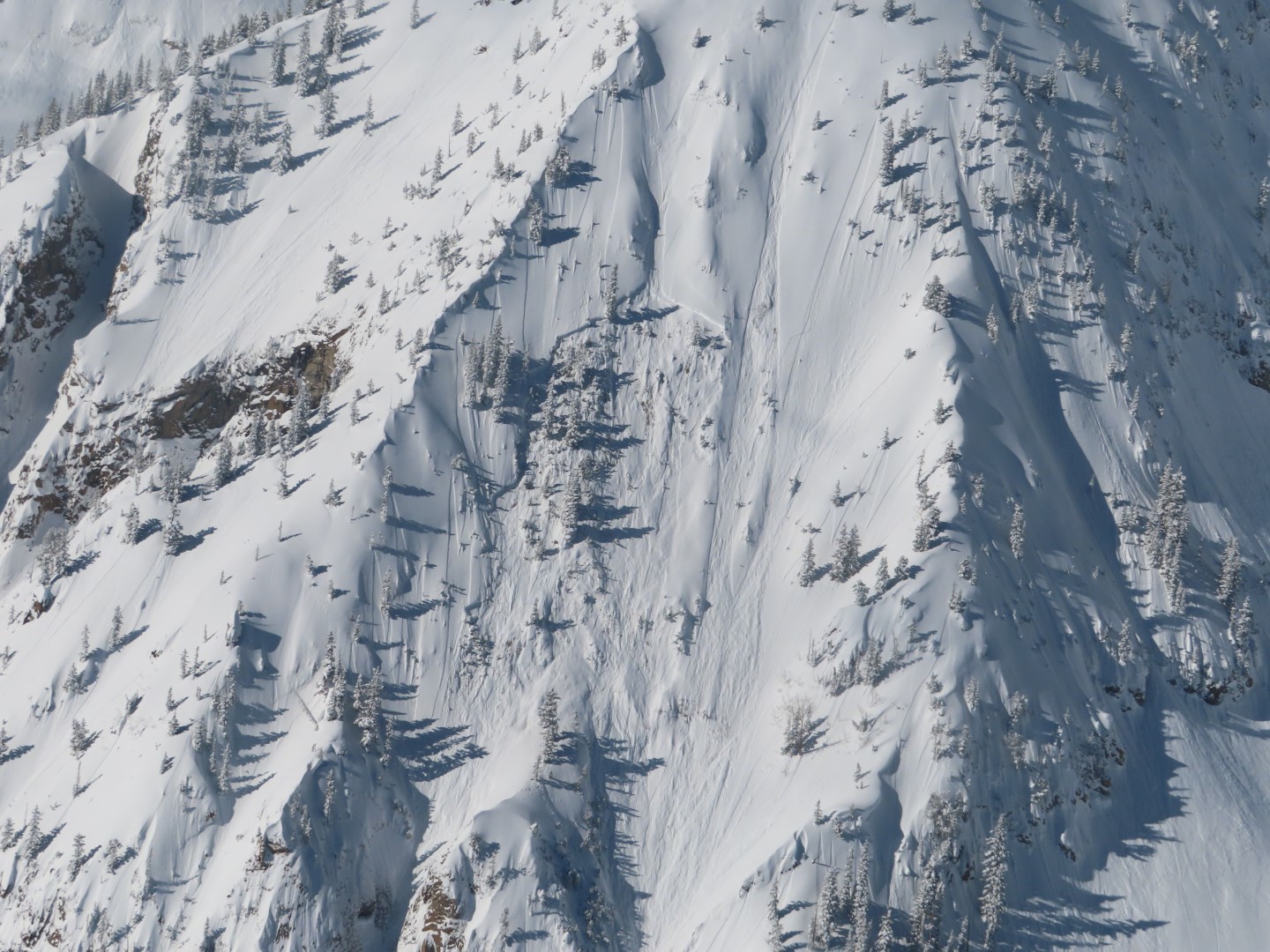
Most avalanche problems today involve small pockets of freshly drifted snow at higher elevations.  There's an outside chance that you can still trigger a large avalanche in very steep, rocky terrain (like this) or on a heavily drifted, unsupported slope (like this).  The safest riding is in wind-sheltered terrain with a deep snowpack.    The danger will rise tomorrow because of increasing winds.  

Lawinenprobleme

  • Wind Slabs

    • Hochgebirge
    • Waldgrenze
    • Unterhalb der Waldgrenze
    Wahrscheinlichkeit
    Possible
    Größe
    1–1.5

    Increasing winds are forming thin wind drifts that will be sensitive to human triggers at higher elevations.  Look for blowing snow or cracking underfoot to identify the problem.  There's a rare chance that you can still trigger a thicker and older wind slab that formed during last week's extreme southwest wind event, in the same type of terrain: below ridgelines, rollovers, and in cross-loaded gullies.  You can avoid the problem in wind-protected or wind-eroded slopes.   

    This recent wind slab on Mt. Baldy exemplifies the expected size and type of terrain of most wind slabs today.  

Avalanche Discussion

The mountains picked up 2" to 7" of low-density snow in the past 24 hours, which will make for excellent surface conditions today.  West-southwest winds overnight were just strong enough to drift the new snow into cohesive and easily triggered soft slabs in the most wind-exposed terrain.  As winds increase later today, watch for the distribution of these thin slabs to expand to more terrain features and start to increase in size.  Today's wind slabs should generally be small, thus only harmful above terrain traps like cliffs, gullies, and trees.  The larger and more dangerous wind slabs that formed last Tuesday are expected to be generally healed up now. If any instabilities involving the older generation of wind slabs are still lingering, they're most likely to be found on very steep, unsupported, heavily wind-drifted slopes.  Tomorrow's intense winds will cause our newest generation of wind slabs to grow larger and more widespread, with the potential for natural activity.

The midweek storm brought an uptick in persistent slab avalanches, primarily in the Southeast Mountains and on the Aspen side that tends to mirror our shallow snowpack zone.  Highlights include a remotely triggered D2 near Friends Hut on Wednesday and a skier-triggered D3 near Aspen Highlands on Thursday.  There are a couple of facet and faceted crust layers in the upper few feet of the snowpack that are the culprits for these issues.  Well-placed stability tests are helpful for identifying potential weaknesses a few feet deep.  The layers weren't quite as well developed and have been crushed harder by previous loading events in the deeper Northwest Mountains, so persistent avalanche activity has been very rare.  We did spot one large avalanche that failed on old weak layers on East Beckwith from the last storm, which failed on a steep, rocky slope with an unusually shallow and weak snowpack.  We've unlisted persistent slabs for the Northwest Mountains this weekend, though there's still an isolated threat if you are traveling in similar terrain as that.  

Abgedeckte Regionen