Peskett Canyon - ice
Bighorn
Grant P , Thursday 2nd May, 2024 6:45PM
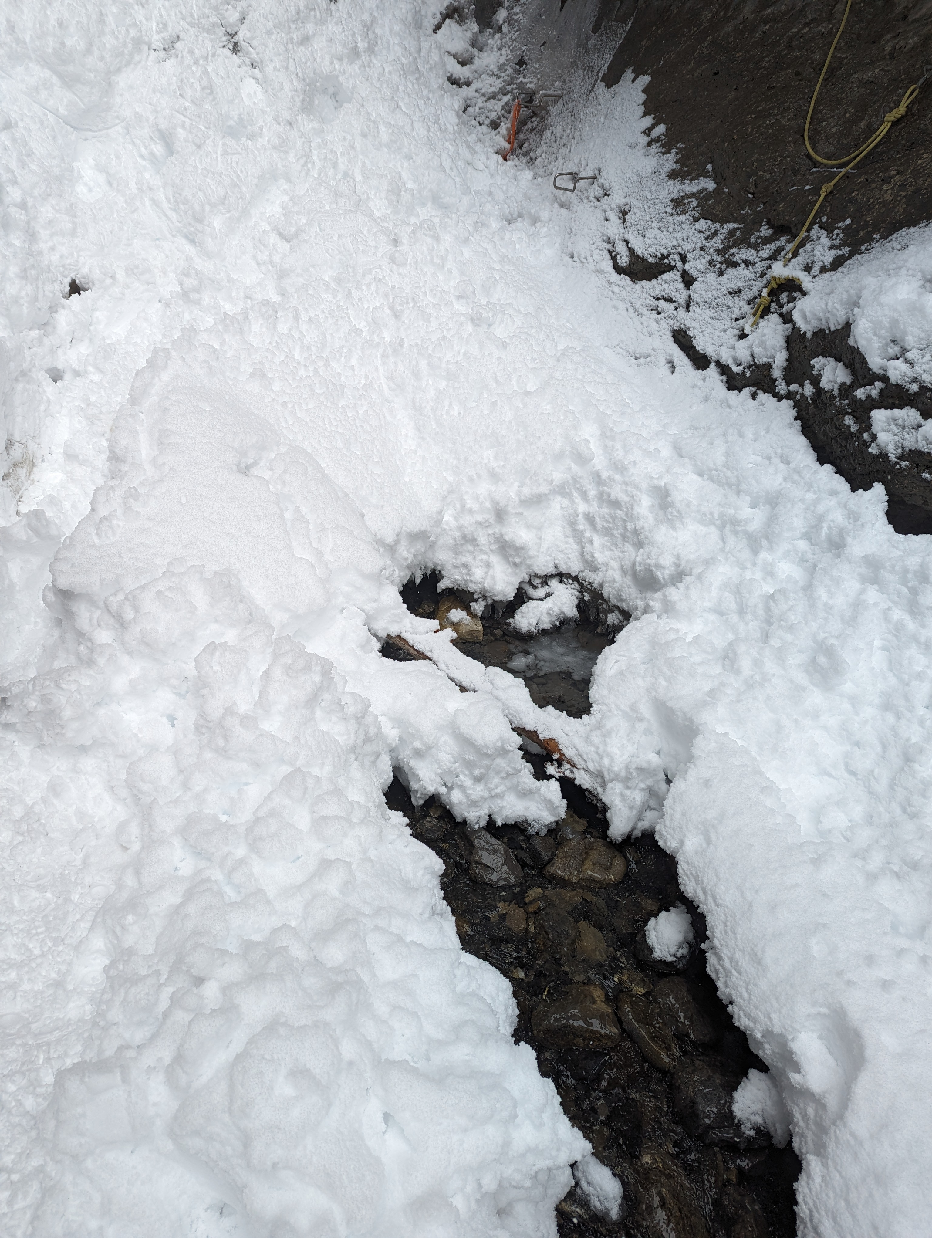
* The drive up through RM House had a little fresh snow but clear roads. Getting to the Nordegg area roads got covered, sometimes deep and wet snow. * Light snow when we parked around 9am and cloudy/foggy. * About 10cm of new snow walking up the ridge above the creek. * Accumulations in the canyon were much deeper. While sometimes it was low similar to the ridge, other places were knee to hip deep for a shortarse. * The new snow hides a few places where you can punch through to holes in the creek that without snow could probably be easily navigated around. Didn't feel like I was going to go for a swim but there are a couple open holes and a few booby traps. **IMPORTANT: Contrary to the book description, which has been transcribed to the app, the avi hazard is not as indicated for the approach. The wording seems to indicate an avi path from the left. It sounds singular and does not identify where it might be found. ++++After new snowfall there are several significant avi slides that fall from above you. ++++ * My observations. The lower canyon prior to the fork had a couple spots where debris accumulated. One of these was from observable slabs just to the right side. The lower canyon is a little less threatened. After the fork, there is a minor slope to the left to be aware of just above the ice step leading into the left fork. The bigger hazard comes from when the upper canyon narrows again. Through this section we encountered several size 1 avalanches that came from above the canyon walls (on both the left AND right sides) and we were unable to see the start zones from our angles. Some of the debris piles were maybe 2-3m deep but may have accumulated from multiple sluffs. Of the slides we saw, none may have completely buried a person but the snow was heavy and may have caught or injured someone below. The hip deep slogging meant it was nearly impossible to move quickly through each impact zone. * I believe we were very close to Lovely Parting Gifts but did not get close enough to see it. The route description left me with the impression that the climb, End Of The Line is not really impacted and that it would be possible to quickly move through the identified avi path on the left. That is wrong and climbers need to be aware of the vastly under stated hazard, especially in the upper canyon, or with recent snowfall. * My partner verbalized his discomfort a couple times and initially we opted to continue. Eventually I dropped the pack in an attempt to move quicker and take a look around the next corner in case I could see either climb (yet another corner though). He apologised a couple times when I agreed to retreat. Despite me believing we were so close, I told him he didn't need to apologise. It is NEVER a "wrong decision" to pull the plug. It may not be fully necessary and we may only have needed to go around another corner but that's not the point. Neither of us were right or wrong, but I hope others can accept sometimes, turning around is what should be done. A lesson I'd like to share. * I'm sure the avalanches were storm snow sluffing from steep accumulation zones, and dropping into the canyon. Maybe the activity will taper off as new snow stops accumulating up there. Remember you cannot see what's up there, and understand you should take full avi gear, including shovel and probe if you are intending going up there in the next couple days. * As we left, the snow had stopped and visibility was clearing. Snacks and bevvies in the car were a good consolation 😂


Source: Avalanche Canada MIN